|
Colorado Springs, between the Oregon and Santa
Fe Trails, is within President Thomas Jefferson’s 1803 Louisiana
Purchase--which included all of Colorado east of the Continental Divide
and cost about 4 cents/acre. This strict-constructionist President acknowledged
that our Constitution didn’t give the federal government specific
authority to purchase territory, but it did give him authority to negotiate
treaties, which the Louisiana Purchase was. Jefferson took this initiative
because it would (1) double the size of the United States, (2) remove
historic French threats from the American frontier, (3) protect American
use of the entire length of the Mississippi River, and (4) give us ownership
of the key port of New Orleans. Congress agreed with him, authorizing
the $15 million price. Napoleon used the money to help finance his preparations
to invade England--a plan canceled after the July 1805 Battle of Cape
Finisterre convinced him that British Navy control of the English Channel
could not be broken. These were huge decisions.
Put another way, what if Napoleon had been smarter and invested in his
North American properties instead of trying to invade England--since he
didn’t do it anyway--or invading Russia in 1812--a huge costly disaster
for him? Perhaps today Colorado Springs would be part of a New France
with New Orleans as its capital? You’d be reading your Gazette in
French--no need to change the newspaper’s name, since the word is
French to start with. No need to change street names such as Bijou…Cache
La Poudre…Willamette… Cascade…Fountain…or St. Vrain
(fur trader Ceran St. Vrain was born in 1802 at French-owned St. Louis,
son of a former commander of the King of France’s personal galley)—all
French names already! Instead of Pike’s Peak, perhaps it would be
Mont Josephine. Bienvenu à la Ville Pour Champions! You get the
idea….
President Jefferson appointed his Secretary, Captain Meriwether Lewis,
a bachelor who lived in the East Room of the President’s Mansion
(largest room in the building—you’ve seen it on TV used for
major presidential press conferences, concerts, et al), to “explore
the Missouri river, & such principal stream of it, as, by its course
& communication with the waters of the Pacific Ocean, may offer the
most direct & practicable water communication across this continent,
for the purposes of commerce….In all your intercourse with the natives
treat them in the most friendly & conciliatory manner which their
own conduct will admit….” In other words, Jefferson hoped he’d
find a Northwest Passage. Lewis asked his former rifle company commander,
Captain William Clark, to serve as his co-commander of what the President
dubbed the “Corps of Discovery,” a mixed military and civilian
unit which varied in size with their needs during the 28-month expedition
between 35 and 45 people. Lewis departed Washington, D.C. on July 5, 1803,
making stops at Harper’s Ferry Federal Armory to get weapons and
other supplies, then at Pittsburgh to oversee construction of a 55-ft
keelboat, then down the Ohio River to Louisville, KY where he and men
he’d recruited met with Clark and his recruits.
On July 21, 1969, many of us stepped outside to gaze at the moon after
watching TV coverage of Neil Armstrong walking up there. In various ways,
the Corps of Discovery’s success in traversing a dangerous long distance
and returning home had similar dramatic impact across American consciousness.
Fortunately for Lewis and Clark, a lot of resident Indian tribes helped
them along the way.
During the 2003-2006 Lewis & Clark Bicentennial Commemoration, many
cities and towns, 16 states, and the big federal Lewis and Clark Interagency
Partnership generated a great number of creative initiatives, including
visitor centers, museums, boat replicas, reenactments and literature that
we benefit from today.
Many folks have since traveled the Corps of Discovery routes out and back,
or parts of them, by boat, car, horse, and/or on foot. Over eight days
in August 2014, I drove from Colorado Springs to follow their route between
Cahokia, IL and Billings, MT, primarily to learn firsthand about potential
opportunities for safe boating along this route—intending to see
parts of it as Lewis and Clark did, given the changes made to many rivers
by the U.S. Army Corps of Engineers—such as six big dams and lakes
in the upper Missouri.
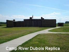
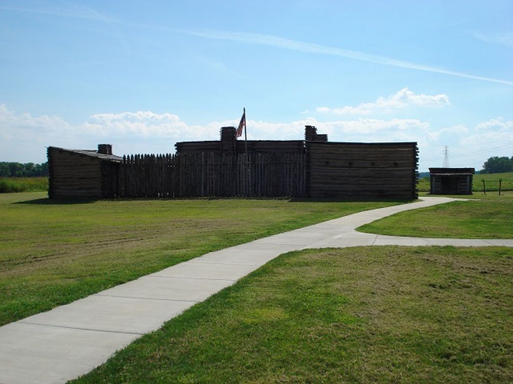
 You
can visit today’s replica of Camp River Dubois, their 1803-4 wintering
camp on the Illinois shore of the Mississippi River opposite its confluence
with the Missouri River, 20 miles north of St. Louis. This site’s
half-section full-length replica gives you a great view of how they loaded
and occupied their keelboat and two pirogues (like a large rowboat—red
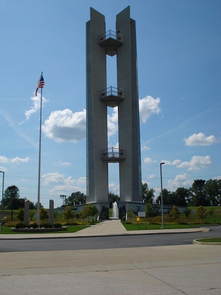
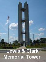
one 41 ft and white one 39 ft). Nearby, you can look over the current
confluence—both rivers have moved since 1804—from Hartford,
IL’s big Lewis & Clark Memorial Tower. A short drive from here
is Illinois’ Cahokia Mounds State Historic Site, where a beautiful
modern museum is on the grounds of what, about the year 1250 A.D., was
a town of some 20,000 corn-growing people of the Mississippian Culture—largest
town on the continent north of Mexico, and larger than London at the time.
While Clark focused on training the Corps to work as a team for the upcoming
trek, Lewis spent much of his time in St. Louis and in the village of
Cahokia procuring supplies. During this 1803-4 winter, the French-owned
town of St. Louis was still under the administration of a Spanish officer,
by odd agreement between those two nations. It was not until March 8,
1804 that the Spanish flag was officially lowered and the French flag
raised; then, on March 10, the French flag was officially replaced by
the 15-star American flag, with Lewis attending. The Corps was now free
to go see what President Jefferson had bought, and Clark started them
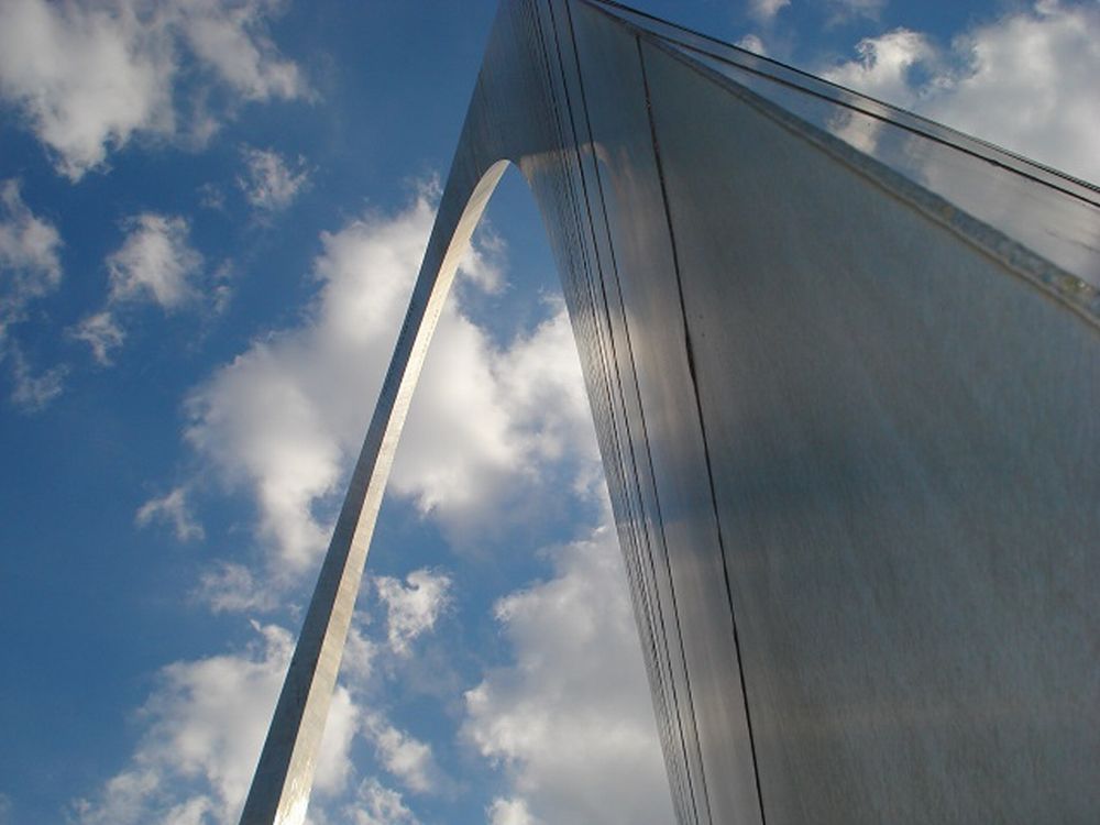
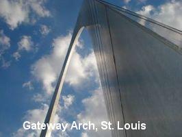
up the Missouri River on May 14, 1804. You can see more about St. Louis,
the Corps, and other western pioneers in the fine museum at the base of
the Gateway Arch on the riverfront in downtown St. Louis. You
can visit today’s replica of Camp River Dubois, their 1803-4 wintering
camp on the Illinois shore of the Mississippi River opposite its confluence
with the Missouri River, 20 miles north of St. Louis. This site’s
half-section full-length replica gives you a great view of how they loaded
and occupied their keelboat and two pirogues (like a large rowboat—red
one 41 ft and white one 39 ft). Nearby, you can look over the current
confluence—both rivers have moved since 1804—from Hartford,
IL’s big Lewis & Clark Memorial Tower. A short drive from here
is Illinois’ Cahokia Mounds State Historic Site, where a beautiful
modern museum is on the grounds of what, about the year 1250 A.D., was
a town of some 20,000 corn-growing people of the Mississippian Culture—largest
town on the continent north of Mexico, and larger than London at the time.
While Clark focused on training the Corps to work as a team for the upcoming
trek, Lewis spent much of his time in St. Louis and in the village of
Cahokia procuring supplies. During this 1803-4 winter, the French-owned
town of St. Louis was still under the administration of a Spanish officer,
by odd agreement between those two nations. It was not until March 8,
1804 that the Spanish flag was officially lowered and the French flag
raised; then, on March 10, the French flag was officially replaced by
the 15-star American flag, with Lewis attending. The Corps was now free
to go see what President Jefferson had bought, and Clark started them
up the Missouri River on May 14, 1804. You can see more about St. Louis,
the Corps, and other western pioneers in the fine museum at the base of
the Gateway Arch on the riverfront in downtown St. Louis.
 Lewis
rode up from St. Louis on May 20 to rejoin the Corps in the riverfront
village of St. Charles. At http://www.lewisandclark.net
you can learn about the Discovery Expedition of St. Charles, which built
replica boats and log canoes for the Bicentennial and, over the four years
of that celebration, sailed, paddled, rode and walked the Corps’
route from Pittsburgh to Oregon, being featured on ABC News, National
Public Radio, and hundreds of local media stations and publications. These
modern reenactors paddled canoes up the Yellowstone River and along the
Columbia River, rode horses over the Continental Divide at Lolo Pass,
camped in the same locations as the original Corps, hosted over half a
million visitors to their boats and campsites, and built the interesting
riverfront Lewis & Clark Boat House and Nature Center that you can
visit today in St. Charles. When I visited, they were hosting the finish
line of the annual Missouri River 340-mile boat race from Kansas City
to St. Charles, which you can read about—and register for—at
http://rivermiles.com/mr340. Impressive group of modern-day adventurers—and
you’re welcome to join them, too. Lewis
rode up from St. Louis on May 20 to rejoin the Corps in the riverfront
village of St. Charles. At http://www.lewisandclark.net
you can learn about the Discovery Expedition of St. Charles, which built
replica boats and log canoes for the Bicentennial and, over the four years
of that celebration, sailed, paddled, rode and walked the Corps’
route from Pittsburgh to Oregon, being featured on ABC News, National
Public Radio, and hundreds of local media stations and publications. These
modern reenactors paddled canoes up the Yellowstone River and along the
Columbia River, rode horses over the Continental Divide at Lolo Pass,
camped in the same locations as the original Corps, hosted over half a
million visitors to their boats and campsites, and built the interesting
riverfront Lewis & Clark Boat House and Nature Center that you can
visit today in St. Charles. When I visited, they were hosting the finish
line of the annual Missouri River 340-mile boat race from Kansas City
to St. Charles, which you can read about—and register for—at
http://rivermiles.com/mr340. Impressive group of modern-day adventurers—and
you’re welcome to join them, too.
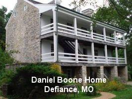 Heading
west from St. Louis along the river, an optional diversion through beautiful
rolling countryside is to swing by the big stone house near Defiance,
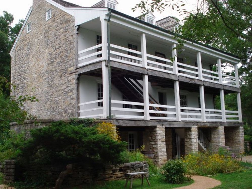
MO where Daniel Boone spent the last of his 86 years. Boone was living
in this area when the Corps came by, but there’s no record of any
interaction. For a Coloradan, the sweet smell of broadleaf forest and
the many tunes of birds and bugs of Midwest meadows out here are pleasant
temporary experience. The lush countryside has bright green grass like
Lexington, KY, and looks like the Cotswolds with cornfields. Farther west,
I dropped into the ongoing Missouri State Fair in Sedalia, MO, and enjoyed
paying 40 cents less for gasoline than here in Colorado Springs. Heading
west from St. Louis along the river, an optional diversion through beautiful
rolling countryside is to swing by the big stone house near Defiance,
MO where Daniel Boone spent the last of his 86 years. Boone was living
in this area when the Corps came by, but there’s no record of any
interaction. For a Coloradan, the sweet smell of broadleaf forest and
the many tunes of birds and bugs of Midwest meadows out here are pleasant
temporary experience. The lush countryside has bright green grass like
Lexington, KY, and looks like the Cotswolds with cornfields. Farther west,
I dropped into the ongoing Missouri State Fair in Sedalia, MO, and enjoyed
paying 40 cents less for gasoline than here in Colorado Springs.
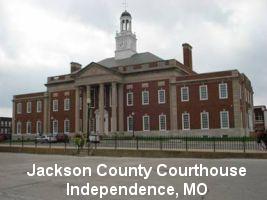 In
Independence, MO, the excellent little National Frontier Trails Museum
hosted an Indian dancing performance during my visit, and the ladies there
were most generous with National Historic Trails literature for future
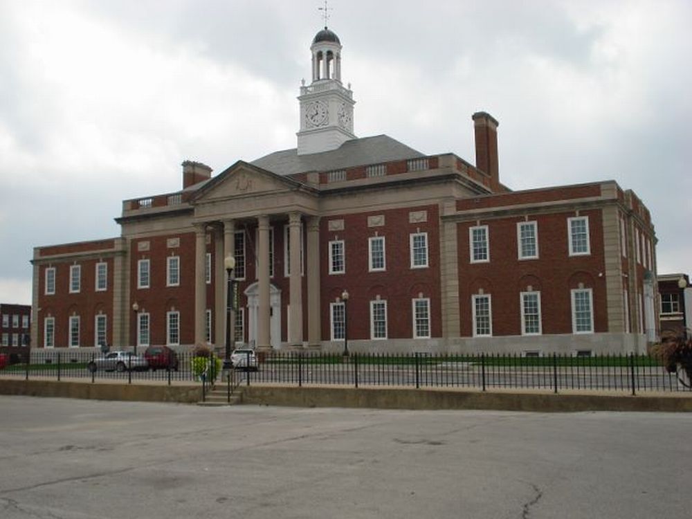
travels. Independence’s courthouse square was a primary outfitting
and stepping-off point for the Santa Fe and Oregon Trails, and paintings
you might see of these wagon trains forming often have the same Jackson
County Courthouse, with its beautiful twin chimneys, in the background.
In 1926, Harry Truman was elected presiding judge of this county court.
The same year, he was elected president of the National Old Trails Road
Association, honoring our pioneers. In
Independence, MO, the excellent little National Frontier Trails Museum
hosted an Indian dancing performance during my visit, and the ladies there
were most generous with National Historic Trails literature for future
travels. Independence’s courthouse square was a primary outfitting
and stepping-off point for the Santa Fe and Oregon Trails, and paintings
you might see of these wagon trains forming often have the same Jackson
County Courthouse, with its beautiful twin chimneys, in the background.
In 1926, Harry Truman was elected presiding judge of this county court.
The same year, he was elected president of the National Old Trails Road
Association, honoring our pioneers.
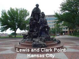 In
Kansas City, overlooking the confluence of the Kansas and Missouri Rivers,
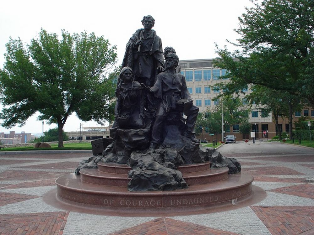
the hilltop Lewis and Clark Point, close to downtown, has a fine statue
of Lewis and Clark, Sacagawea and her baby “Pomp,” Lewis’s
slave York, and Lewis’s Newfoundland dog Seaman. At 18 ft tall, this
is the largest statue in their honor in the nation. During my entire trip,
not only was Seaman included in every statue, but Seaman’s Park,
near Washburn, ND, has a big statue of just Seaman alone! Along the way,
I also found five different books dedicated to Seaman’s perspective
of the expedition—three of which were written “by” Seaman.
We Americans do like our dogs…. In
Kansas City, overlooking the confluence of the Kansas and Missouri Rivers,
the hilltop Lewis and Clark Point, close to downtown, has a fine statue
of Lewis and Clark, Sacagawea and her baby “Pomp,” Lewis’s
slave York, and Lewis’s Newfoundland dog Seaman. At 18 ft tall, this
is the largest statue in their honor in the nation. During my entire trip,
not only was Seaman included in every statue, but Seaman’s Park,
near Washburn, ND, has a big statue of just Seaman alone! Along the way,
I also found five different books dedicated to Seaman’s perspective
of the expedition—three of which were written “by” Seaman.
We Americans do like our dogs….
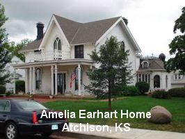 North
of Kansas City is the Lewis and Clark Pavilion in Riverfront Park, Atchison,
KS, where the Corps camped. From her birthplace home just up a hill overlooking
the river, young Amelia Earhart could walk down to this site. You can
tour that pretty house today. Also in Atchison is a handsome Atchison,
Topeka & Santa Fe Railroad museum. Then, a little way up the river
is St. Joseph, MO, where the excellent Pony Express National Memorial
and Museum is worth a look. St. Joe was a base for the Oregon and California
Trails, as well as a key riverboat and railroad town. The Hannibal and
St. Joseph Railroad was the first railroad across Missouri. This pioneering
railroad company, formed in 1846 in the Hannibal office of John Clemens,
father of Samuel Clemens, reportedly on April 3, 1860 brought the first
letter from the East to be delivered to California by the Pony Express.
In 1861, the first Civil War assignment for Colonel Ulysses S. Grant was
to protect this railroad. St. Joe also hosts the little house where Bob
Ford shot and killed Jesse James in 1882, after which he fled the state
and later operated a saloon in Creede, CO, until he was murdered there
in 1892 with a shotgun load to the throat. North
of Kansas City is the Lewis and Clark Pavilion in Riverfront Park, Atchison,
KS, where the Corps camped. From her birthplace home just up a hill overlooking
the river, young Amelia Earhart could walk down to this site. You can
tour that pretty house today. Also in Atchison is a handsome Atchison,
Topeka & Santa Fe Railroad museum. Then, a little way up the river
is St. Joseph, MO, where the excellent Pony Express National Memorial
and Museum is worth a look. St. Joe was a base for the Oregon and California
Trails, as well as a key riverboat and railroad town. The Hannibal and
St. Joseph Railroad was the first railroad across Missouri. This pioneering
railroad company, formed in 1846 in the Hannibal office of John Clemens,
father of Samuel Clemens, reportedly on April 3, 1860 brought the first
letter from the East to be delivered to California by the Pony Express.
In 1861, the first Civil War assignment for Colonel Ulysses S. Grant was
to protect this railroad. St. Joe also hosts the little house where Bob
Ford shot and killed Jesse James in 1882, after which he fled the state
and later operated a saloon in Creede, CO, until he was murdered there
in 1892 with a shotgun load to the throat.
 Upriver
in Nebraska City is the pretty Missouri River Basin Lewis and Clark Interpretive
Trail and Visitor Center, with a part-replica keelboat and pirogue. I
had dinner nearby at the gorgeous Lied Lodge & Conference Center,
and walked around Arbor Day Farm—built by the Morton family that
also initiated Arbor Day and founded Morton Salt. As an indicator of how
much they like trees, the Lodge’s parking lot alone has over 400
varieties of trees that you park under. Keeps the car cool! Farther upriver,
Council Bluffs, IA has an excellent Western Historic Trails Center. But
this is not the Council Bluffs site across the river in Nebraska where
Lewis and Clark had their first meeting with Native Americans—Oto
and Missouri Indians—about 15 miles north of today’s Omaha,
where Fort Atkinson State Historical Park is now. Speaking of Indians,
at each of these meetings Lewis impressed them by demonstrating his Girandoni
repeating air rifle, which was used by the Austrian army against Napoleon--it
impressed me, too, especially after watching this video from the NRA National
Firearms Museum: http://www.network54.com/Forum/451309/thread/1296928404 Upriver
in Nebraska City is the pretty Missouri River Basin Lewis and Clark Interpretive
Trail and Visitor Center, with a part-replica keelboat and pirogue. I
had dinner nearby at the gorgeous Lied Lodge & Conference Center,
and walked around Arbor Day Farm—built by the Morton family that
also initiated Arbor Day and founded Morton Salt. As an indicator of how
much they like trees, the Lodge’s parking lot alone has over 400
varieties of trees that you park under. Keeps the car cool! Farther upriver,
Council Bluffs, IA has an excellent Western Historic Trails Center. But
this is not the Council Bluffs site across the river in Nebraska where
Lewis and Clark had their first meeting with Native Americans—Oto
and Missouri Indians—about 15 miles north of today’s Omaha,
where Fort Atkinson State Historical Park is now. Speaking of Indians,
at each of these meetings Lewis impressed them by demonstrating his Girandoni
repeating air rifle, which was used by the Austrian army against Napoleon--it
impressed me, too, especially after watching this video from the NRA National
Firearms Museum: http://www.network54.com/Forum/451309/thread/1296928404
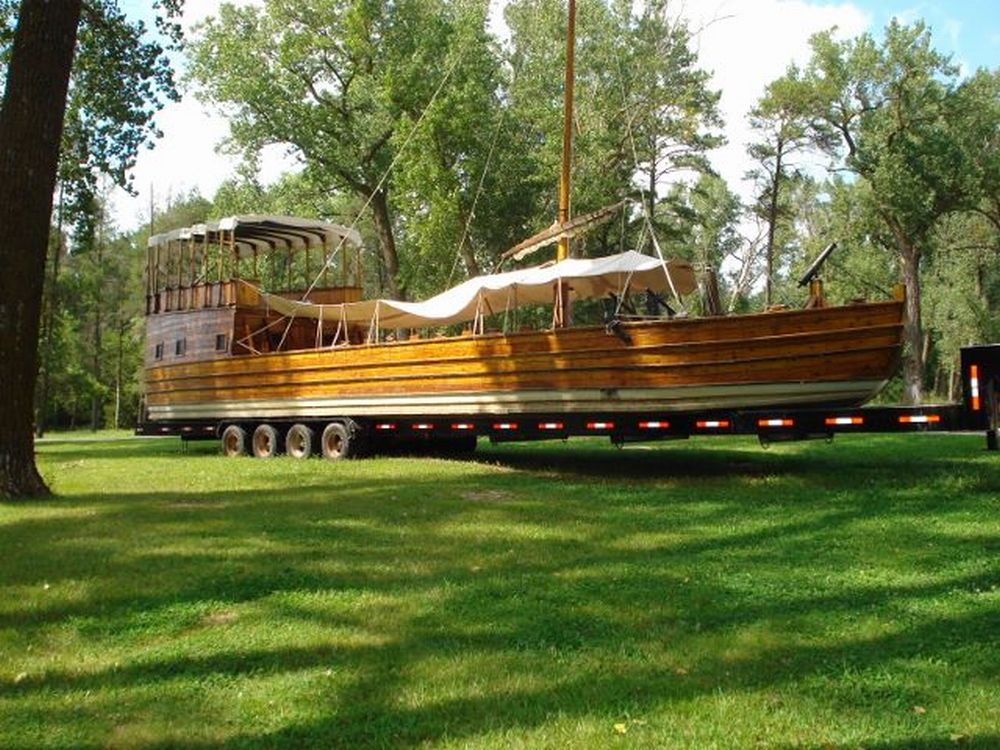
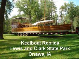
 Northward
by the little town of Onawa, IA, Lewis and Clark State Park has a gorgeous
set of full-scale keelboat and pirogue replicas—reportedly the best
in the country. This park is located on an oxbow lake with a marker where
the Corps camped, but where the oxbow is now separated from the main river
channel. It has big trees and lots of camping spaces, and the lake is
busy with swimmers, boaters and water skiers. Farther up, Sioux City,
IA has a nice Lewis and Clark Interpretive Center, co-located with a pretty
park, a big Hilton Garden Inn, restaurants, a marina, and a wide double
boat ramp. For folks like us looking to take their motor boat safely down
the Missouri to St. Louis, I was repeatedly told to start no farther up
than Sioux City, due to the river’s notorious moving sandbars, hidden
tree-root snags, false channels, ubiquitous floating logs, and lack of
Corps of Engineers or Coast Guard channel maintenance or marking above
here. And this park/hotel/restaurant/marina combination looked like a
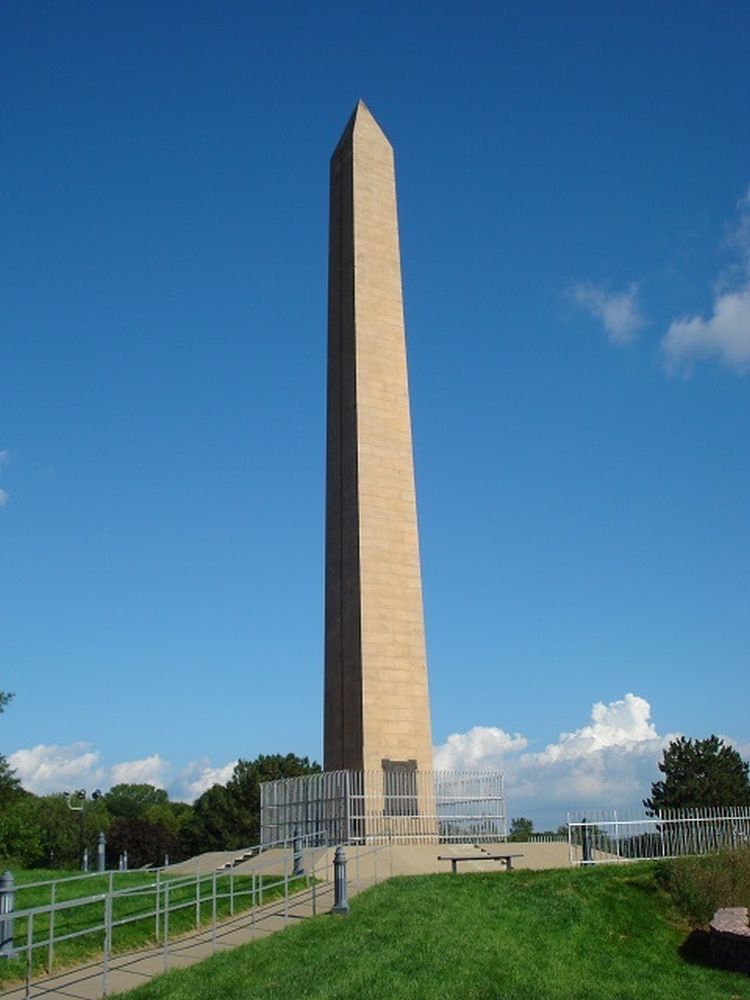
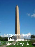
fine launching point for a Coloradan. Just outside Sioux City is Sergeant
Floyd Monument, a 100-ft obelisk built in 1901 on a hill overlooking the
river, where Lewis and Clark buried the only Corps member who died during
their dangerous 28-month expedition—it is commonly thought by a burst
appendix. This monument was the first-ever site in the United States designated
as a National Historic Landmark. Northward
by the little town of Onawa, IA, Lewis and Clark State Park has a gorgeous
set of full-scale keelboat and pirogue replicas—reportedly the best
in the country. This park is located on an oxbow lake with a marker where
the Corps camped, but where the oxbow is now separated from the main river
channel. It has big trees and lots of camping spaces, and the lake is
busy with swimmers, boaters and water skiers. Farther up, Sioux City,
IA has a nice Lewis and Clark Interpretive Center, co-located with a pretty
park, a big Hilton Garden Inn, restaurants, a marina, and a wide double
boat ramp. For folks like us looking to take their motor boat safely down
the Missouri to St. Louis, I was repeatedly told to start no farther up
than Sioux City, due to the river’s notorious moving sandbars, hidden
tree-root snags, false channels, ubiquitous floating logs, and lack of
Corps of Engineers or Coast Guard channel maintenance or marking above
here. And this park/hotel/restaurant/marina combination looked like a
fine launching point for a Coloradan. Just outside Sioux City is Sergeant
Floyd Monument, a 100-ft obelisk built in 1901 on a hill overlooking the
river, where Lewis and Clark buried the only Corps member who died during
their dangerous 28-month expedition—it is commonly thought by a burst
appendix. This monument was the first-ever site in the United States designated
as a National Historic Landmark.
 Nebraska
along the Missouri River appears to be mostly rolling. When you enter
South Dakota, suddenly things get pretty flat. But the farmland remains
gorgeous this year, and you can expect record national crops of corn,
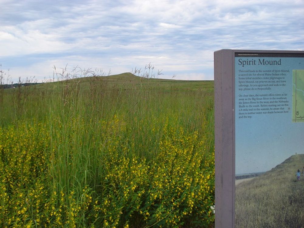
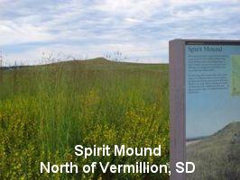
wheat, soybeans, and sunflower seeds. North of the town of Vermillion,
SD is Spirit Mound, which local Indians told the Corps was populated with
18-inch-tall spirits that would kill any human approaching the hill. Of
course, Lewis and Clark had to check it out, and from its peak they saw
their first large herds of bison. You can climb the Mound, as it’s
now part of a South Dakota “historic prairie.” Nebraska
along the Missouri River appears to be mostly rolling. When you enter
South Dakota, suddenly things get pretty flat. But the farmland remains
gorgeous this year, and you can expect record national crops of corn,
wheat, soybeans, and sunflower seeds. North of the town of Vermillion,
SD is Spirit Mound, which local Indians told the Corps was populated with
18-inch-tall spirits that would kill any human approaching the hill. Of
course, Lewis and Clark had to check it out, and from its peak they saw
their first large herds of bison. You can climb the Mound, as it’s
now part of a South Dakota “historic prairie.”
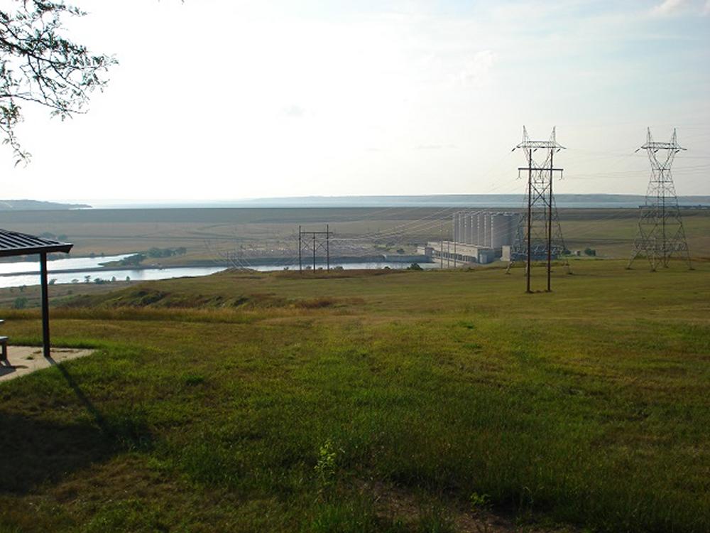
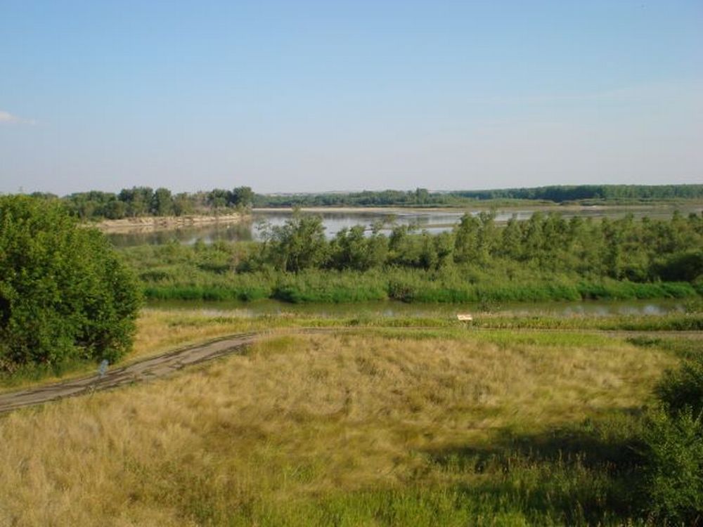
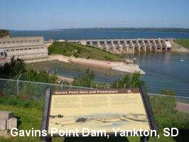 Reaching
Yankton, SD, you arrive at Gavins Point Dam and its Lewis and Clark Lake,
one of the six big dam and lake complexes built by the U.S. Army Corps
of Engineers (USACE) to minimize annual spring flooding and to generate
electricity. These long lakes are a pretty blue, and not silt-laden like
the naturally-flowing segments of river, but way out here in the countryside
their banks are pretty much left natural—very little human presence.
They’re notorious for high winds and big waves, so you don’t
want to get too far out there in a boat alone. Overlooking this dam is
the excellent USACE Lewis and Clark Visitor Center, and nearby is the
U.S. Fish & Wildlife Service’s Gavins Point National Fish Hatchery
and Aquarium that encourages visitors and lets you feed the fish. Right
by the dam is also the big Lewis & Clark Marina and the pleasant Lewis
& Clark Resort with motel units and cabins—but open only mid-April
to mid-October. It’s best to check their website at www.lewisandclarkpark.com. Reaching
Yankton, SD, you arrive at Gavins Point Dam and its Lewis and Clark Lake,
one of the six big dam and lake complexes built by the U.S. Army Corps
of Engineers (USACE) to minimize annual spring flooding and to generate
electricity. These long lakes are a pretty blue, and not silt-laden like
the naturally-flowing segments of river, but way out here in the countryside
their banks are pretty much left natural—very little human presence.
They’re notorious for high winds and big waves, so you don’t
want to get too far out there in a boat alone. Overlooking this dam is
the excellent USACE Lewis and Clark Visitor Center, and nearby is the
U.S. Fish & Wildlife Service’s Gavins Point National Fish Hatchery
and Aquarium that encourages visitors and lets you feed the fish. Right
by the dam is also the big Lewis & Clark Marina and the pleasant Lewis
& Clark Resort with motel units and cabins—but open only mid-April
to mid-October. It’s best to check their website at www.lewisandclarkpark.com.
Northward at the intersection of I-90 and the Missouri River, and near
Big Bend Dam, the town of Chamberlain, SD’s Lewis and Clark Information
Center has a keelboat replica overlooking the river. Farther west is the
state capital, Pierre, pronounced by locals PEER. The city was named after
the original 1831 Fort Pierre across the river, a trading post built by
and named for Pierre Cadet Chouteau, son of wealthy fur trader and presidentially-appointed
Indian Agent Jean Pierre Chouteau, who hosted Lewis & Clark in St.
Louis before their 1804 departure. Unlike normal American practice, Mr.
Chouteau’s first name was used to name the fort and city. Aren’t
you glad that our Nation’s Capital (just up the Potomac from Fort
Washington, MD) isn’t named “George, D.C.?”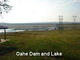 It was here in the Pierre area that Lewis and Clark had a guns-drawn/arrows
notched confrontation with three Teton/Brule Sioux chiefs and an estimated
200 warriors, ended satisfactorily only after Lewis & Clark refused
to back down in the face of their demands that the whites were not allowed
to go upriver unless they gave up one of their pirogues with all its cargo.
Near the State Capitol in downtown is the excellent South Dakota Cultural
Heritage Center, celebrating the state’s centennial in 1989. Driving
north toward the big Oahe Dam and Lake, at the edge of Pierre you’ll
pass a historical marker at the field where Charles Lindbergh landed The
Spirit of St. Louis during his 1927 tour visiting all the state capitals—after
rocks and cattle had been removed from the field. Later, the city bought
this field and made it Pierre’s first airport. In his welcoming speech,
Governor Bulow said that it was time for all cities to develop airports,
and predicted that, someday, a man would fly to the moon and return to
tell about it.
It was here in the Pierre area that Lewis and Clark had a guns-drawn/arrows
notched confrontation with three Teton/Brule Sioux chiefs and an estimated
200 warriors, ended satisfactorily only after Lewis & Clark refused
to back down in the face of their demands that the whites were not allowed
to go upriver unless they gave up one of their pirogues with all its cargo.
Near the State Capitol in downtown is the excellent South Dakota Cultural
Heritage Center, celebrating the state’s centennial in 1989. Driving
north toward the big Oahe Dam and Lake, at the edge of Pierre you’ll
pass a historical marker at the field where Charles Lindbergh landed The
Spirit of St. Louis during his 1927 tour visiting all the state capitals—after
rocks and cattle had been removed from the field. Later, the city bought
this field and made it Pierre’s first airport. In his welcoming speech,
Governor Bulow said that it was time for all cities to develop airports,
and predicted that, someday, a man would fly to the moon and return to
tell about it.
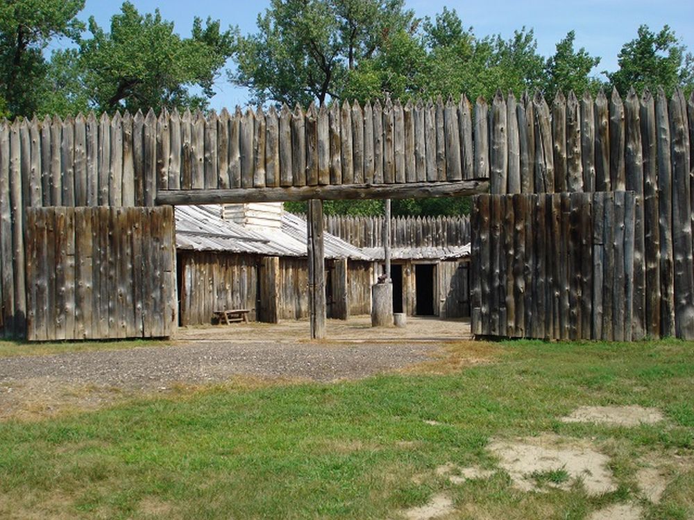
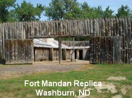 North
of Bismarck is the town of Washburn, ND, near which you find the North
Dakota Lewis and Clark Interpretive Center and the excellent modern replica
of Fort Mandan, which the Corps built for their 1804-5 wintering-over
near the five Mandan, Minitari/Hidatsa and Amahami Indian villages on
both sides of the river, among which some 4,400 people lived. It is here
that French-Canadian trapper Toussaint Charbonneau and his Shoshone wife
Sacagawea (est. age 14-17) joined the Corps. In her Idaho Lemhi Shoshone
language, the name is pronounced Sah-cah-ja-WE-ah. You often hear the
harder North Dakota Mandan pronunciation Sa-KAH-ka-we-ah, and see the
matching spelling for the 178-mile Lake Sakakawea above Garrison Dam.
She helped the Corps in many ways, not least of which being that no Indian
war party would take a woman and baby along, which helped Indians they
met decide that the Corps’ intentions were peaceful. On April 7,
1805, Lewis and Clark sent the keelboat crewed by 11 men back downriver
to St. Louis, with botanical and biological specimens for President Jefferson,
then departed upriver with a total of 33 people in the two pirogues and
six dugout canoes. North
of Bismarck is the town of Washburn, ND, near which you find the North
Dakota Lewis and Clark Interpretive Center and the excellent modern replica
of Fort Mandan, which the Corps built for their 1804-5 wintering-over
near the five Mandan, Minitari/Hidatsa and Amahami Indian villages on
both sides of the river, among which some 4,400 people lived. It is here
that French-Canadian trapper Toussaint Charbonneau and his Shoshone wife
Sacagawea (est. age 14-17) joined the Corps. In her Idaho Lemhi Shoshone
language, the name is pronounced Sah-cah-ja-WE-ah. You often hear the
harder North Dakota Mandan pronunciation Sa-KAH-ka-we-ah, and see the
matching spelling for the 178-mile Lake Sakakawea above Garrison Dam.
She helped the Corps in many ways, not least of which being that no Indian
war party would take a woman and baby along, which helped Indians they
met decide that the Corps’ intentions were peaceful. On April 7,
1805, Lewis and Clark sent the keelboat crewed by 11 men back downriver
to St. Louis, with botanical and biological specimens for President Jefferson,
then departed upriver with a total of 33 people in the two pirogues and
six dugout canoes.
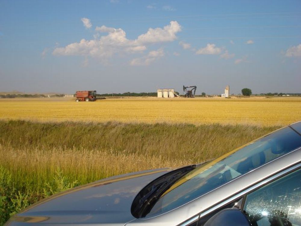
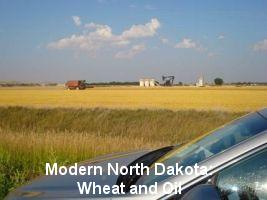
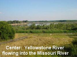 Just
west of Williston, ND, close to Montana—and right in the middle of
today’s fracking oil rush in the Bakken Formation where wheat threshers
mix with countless crude oil tanker trucks and Burlington Northern tank-car
trains—the Fort Buford State Historic Site hosts the nice Missouri-Yellowstone
Confluence Center. In 1881, Sitting Bull surrendered at this cavalry and
infantry fort. Two miles from Fort Buford is the Fort Union Trading Post
National Historic Site. Fort Union trading post was originally built in
1828 by John Jacob Astor’s American Fur Company—and was part
of the Missouri River segment of that company later bought by Pierre Cadet
Chouteau, mentioned above. A key crossroads in early western exploration,
Fort Union was visited by mountain man Jim Bridger, artists George Catlin
and John James Audubon, European naturalist Prince Maximilian, and Belgian
Jesuit missionary Father Pierre De Smet. Just
west of Williston, ND, close to Montana—and right in the middle of
today’s fracking oil rush in the Bakken Formation where wheat threshers
mix with countless crude oil tanker trucks and Burlington Northern tank-car
trains—the Fort Buford State Historic Site hosts the nice Missouri-Yellowstone
Confluence Center. In 1881, Sitting Bull surrendered at this cavalry and
infantry fort. Two miles from Fort Buford is the Fort Union Trading Post
National Historic Site. Fort Union trading post was originally built in
1828 by John Jacob Astor’s American Fur Company—and was part
of the Missouri River segment of that company later bought by Pierre Cadet
Chouteau, mentioned above. A key crossroads in early western exploration,
Fort Union was visited by mountain man Jim Bridger, artists George Catlin
and John James Audubon, European naturalist Prince Maximilian, and Belgian
Jesuit missionary Father Pierre De Smet.
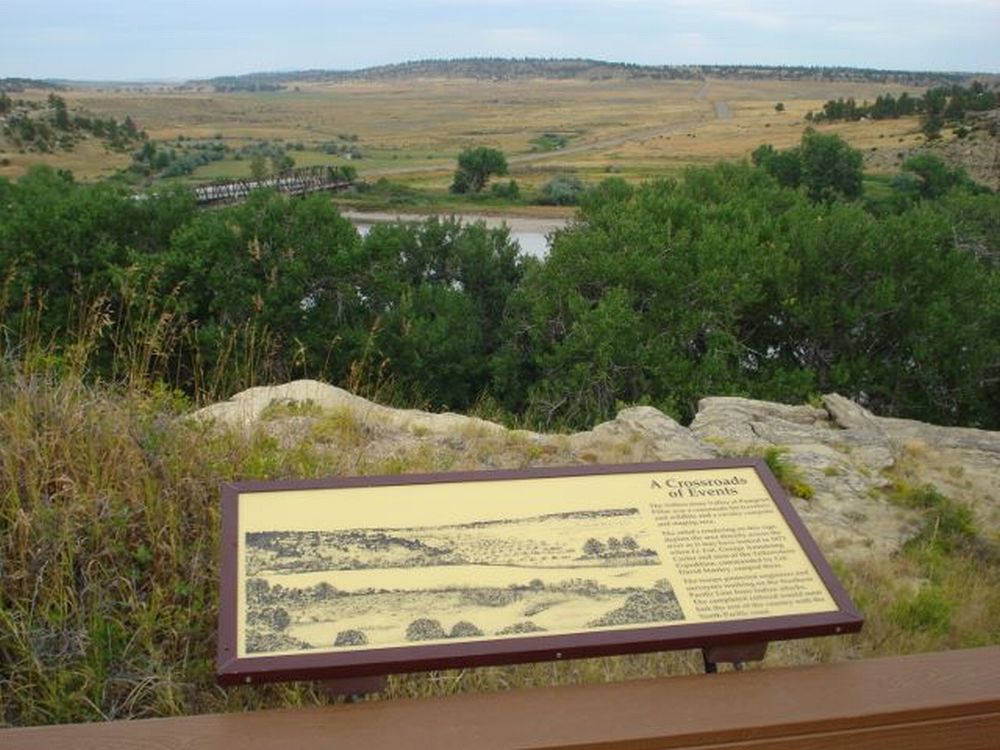
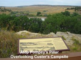
 Wrestling
along two-lane country roads full of trucks loaded with crude oil or dirt,
I got into Montana and onto I-94 for my last stop on this trip: Pompey’s
Pillar National Monument, beside the Yellowstone River east of Billings,
MT. Here you can see William Clark’s signature carved by him into
the big stone, which he originally named “Pompy’s Tower”
(Clark was an especially creative speller) in honor of Sacagawea’s
now 17-month-old son, whom Clark later hosted and educated in St. Louis.
Atop the tower, having raced up against ferocious mosquitoes (spray mandatory—and
offered free in the visitor center), you can look down at a riverside
campsite used by Custer’s 7th Cavalry battalion on their way to the
Little Bighorn. Wrestling
along two-lane country roads full of trucks loaded with crude oil or dirt,
I got into Montana and onto I-94 for my last stop on this trip: Pompey’s
Pillar National Monument, beside the Yellowstone River east of Billings,
MT. Here you can see William Clark’s signature carved by him into
the big stone, which he originally named “Pompy’s Tower”
(Clark was an especially creative speller) in honor of Sacagawea’s
now 17-month-old son, whom Clark later hosted and educated in St. Louis.
Atop the tower, having raced up against ferocious mosquitoes (spray mandatory—and
offered free in the visitor center), you can look down at a riverside
campsite used by Custer’s 7th Cavalry battalion on their way to the
Little Bighorn.
 The
drive home to Colorado Springs from Billings took most of a day. My entire
trip beginning and ending in Colorado Springs amounted to 3,300 miles
over eight days—covering only a fraction of what the Corps of Discovery
did out and back over 28 months, and leaving much to look forward to seeing
in the future. To prepare and get the most out of such a trip, I recommend
reading three books in this order: (1) Stephen Ambrose’s Undaunted
Courage because it’s a fun read, (2) the Journals of Lewis and
Clark so that you know you’ve seen exactly what they wrote, and (3)
Julie Fanselow’s Traveling the Lewis and Clark Trail, which
was my key reference for what’s out there to see by car today. No
need for a passport, language dictionary, or hundred-dollar park-hopper
tickets. Made in America. Real stuff that matters. And fun. The
drive home to Colorado Springs from Billings took most of a day. My entire
trip beginning and ending in Colorado Springs amounted to 3,300 miles
over eight days—covering only a fraction of what the Corps of Discovery
did out and back over 28 months, and leaving much to look forward to seeing
in the future. To prepare and get the most out of such a trip, I recommend
reading three books in this order: (1) Stephen Ambrose’s Undaunted
Courage because it’s a fun read, (2) the Journals of Lewis and
Clark so that you know you’ve seen exactly what they wrote, and (3)
Julie Fanselow’s Traveling the Lewis and Clark Trail, which
was my key reference for what’s out there to see by car today. No
need for a passport, language dictionary, or hundred-dollar park-hopper
tickets. Made in America. Real stuff that matters. And fun.
| The author, former speechwriter for five different four-star commanders
of NORAD and U.S. Northern Command here in Colorado Springs, is a
1968 graduate of the U.S. Air Force Academy whose 30-year Air Force
career included duties as military assistant/aide to the vice president,
vice commander of a cruise missile wing, and commander of a 5,000-person
combat support wing, with assignments in five foreign countries, HQ
U.S. Air Force, Organization of the Joint Chiefs of Staff, Office
of the Secretary of Defense, White House, State Department, and United
Nations Headquarters. Bill was appointed by Governor Owens to a two-year
term as a member of the Colorado Emergency Planning Commission, and
led a civilian consulting team working with New York State’s
ten major agencies involved in disaster response six months after
9/11. He and his wife Sue enjoy exploring America. Contact him at
billsueeckert@aol.com |
|